

Thunderstorms could move into the Myrtle Beach area Monday evening, bringing the possibility of severe weather.
Storms are expected to hit the Myrtle Beach area between 6 p.m. and 7 p.m., said Stephen Keebler with the National Weather Service.
Strong winds are the main threat, with winds gusts getting up to 60 mph or greater, according to the National Weather Service in Wilmington. Winds could bring down trees or power lines. Lauren Warner with the National Weather Service urges people to tie down anything at risk of flying away.
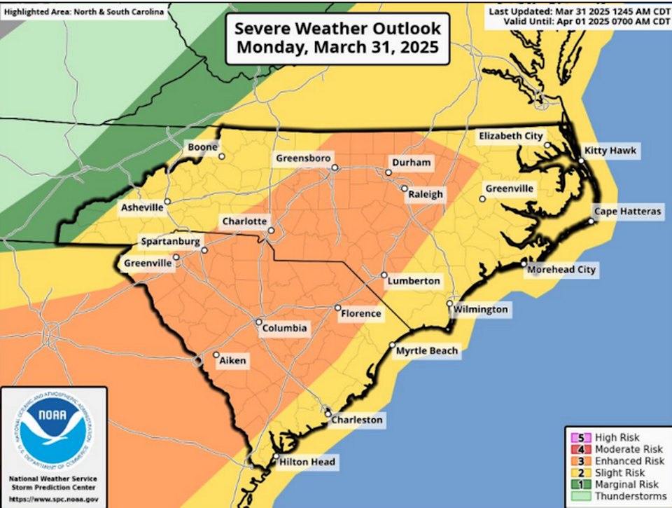
A severe storm is moving across the Carolinas on March 31. The Myrtle Beach area is under a slight severe weather risk.
There is a slight chance for tornadoes and quarter sized hail or larger, which is always possible with strong systems, Keebler said.
Advertisement
Advertisement
Horry County is at a slight risk for severe weather, while other parts of the state are at an elevated risk, according to the National Weather Service.
“This is the strongest systems we get outside of hurricanes,” Keebler said.
Check to see how the Grand Strand is faring using live streams. There are cams set up across the area, including in downtown Myrtle Beach, Cherry Grove and Murrells Inlet. Find the full list of live streams here.
This post was originally published on here


