The country is in the clutches of the coldest air of the season with more than 40 states, including Massachusetts, seeing cold weather alerts at some point this week. Nearly every state from Texas to Maine, including sunny Florida, continues to feel this Arctic blast, dropping temperatures as low as 30 to 40 degrees below normal for some locations.
Unlike in February 2023 when polar vortex slipped New England into a deep freeze, this rush of cold air has certainly been influenced by the vortex but it’s not the main culprit.
High pressure and the polar vortex
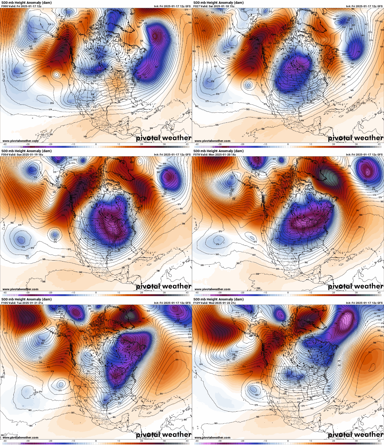
A massive dome of high pressure — virtually a mass of sinking air — already sitting above central Canada pulled a sliver of the chilled polar vortex into the United States late last weekend. That surge of frigid air exacerbated already cold temperatures in the Northeast and Mid-Atlantic regions.
The polar vortex lives in the tropopause, a boundary between the two lowest layers of Earth’s atmosphere — the stratosphere and the troposphere, where nearly all weather occurs.
If we take a peek at the tropopause you can see a sliver of the polar vortex — the light gray and white in the map below — funneling south Sunday morning.
The jet stream
At the same time, a weak jet stream, the “conveyor belt” of fast-moving air in the upper atmosphere, further kicked the cold air into motion. With the jet stream so high to the north of Alaska, the east side dipped far to the south and interacted with the polar vortex briefly before doing so, which sped up the descent of cold air south from Canada.
This blast of cold air migrated far enough south to take hold over several Southern states, from Texas to Florida, on Tuesday infusing frigid temperatures into a once-in-a-generation storm system that hammered regions unaccustomed to the wintry onslaught. The South has seen record-breaking snowfall and low temps.
The loop below shows cold air moving across much of the eastern half of the country and moving out over the Atlantic.

Here’s another angle of the surface temperatures in response to the arrival of the strong high pressure expanding south, pushing the jet stream to the Gulf of Mexico and setting up cold temperatures through Wednesday night.

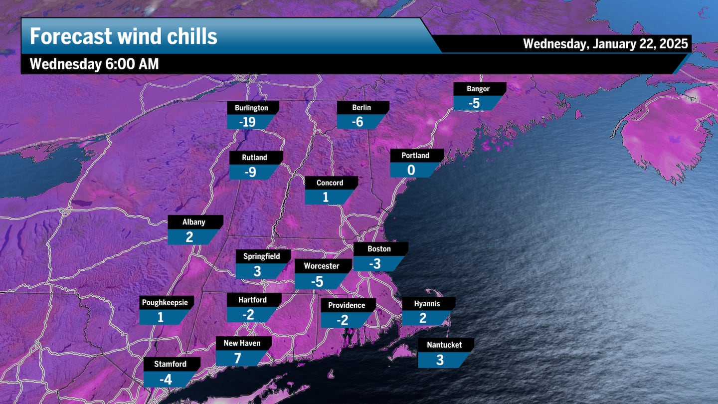
New England has remained mostly on the fringe of this massive cold weather outbreak, which has led to very cold temperatures, but nothing we haven’t seen before. Wednesday morning was the coldest stretch of this event, with wind chills in the negatives for Boston on the commute in. Wind chills were worse in parts of western and northern New England, plunging as low as 15 below.
Take a look at Burlington, Vt., on Wednesday morning:

New England has seen its fair share of colder-than-average temperatures this December and January, much colder than last year’s exceptionally warm winter, but these cold snaps haven’t strayed too far from the norm. It’s just that we haven’t experienced these chilly fluctuations in a while.
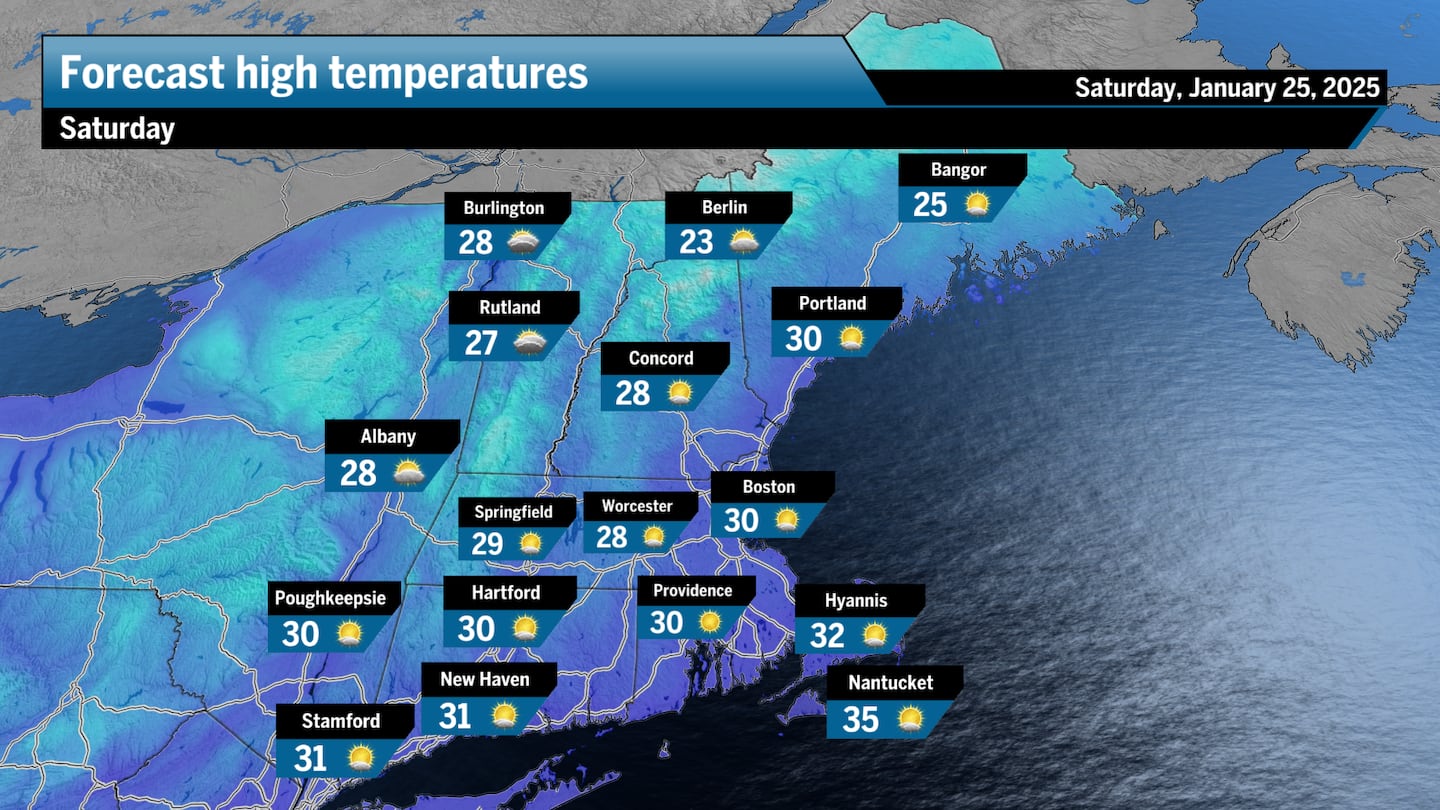
Looking ahead, temperatures are expected to gradually shift closer to seasonable averages by the weekend.

Ken Mahan can be reached at [email protected]. Follow him on Instagram @kenmahantheweatherman.
This post was originally published on here


