This post was originally published on here
SAN DIEGO (FOX 5/KUSI) — After powerful rainstorms soaked San Diego County over the holidays, scientists are closely monitoring how that water is reshaping the region’s coastline.
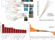
Researchers with Scripps Institution of Oceanography are driving up and down the coast this week using high-tech laser scanners to measure erosion along beaches and coastal bluffs, including areas near Torrey Pines State Beach.
The weekly surveys, which have been ongoing for years, are revealing increased erosion and small landslides following the recent rainfall, according to scientists.
Advertisement
Advertisement
“From the sand to the cliffs high above it, San Diego’s coastline is constantly changing,” said Adam Young, a researcher at Scripps.
Young said the team uses laser scanners mounted on a truck to send pulses of light toward the beach and cliffs, creating highly detailed maps of the coast.
“Essentially we drive down the beach and we have laser scanners that send laser pulses from the scanner, and they bounce off the surface of either the beach or the bluff,” Young said.
While the vehicle may look ordinary from the outside, it is packed with specialized cameras and scanning equipment capable of mapping the entire coastline in high resolution.
Advertisement
Advertisement
“We’re able to map out the entire coastline altogether,” Young said. “So we’re mapping the beaches, the cliffs and the water levels.”
Following the heavy rain San Diego experienced over the holidays, researchers said the data shows rainfall remains one of the biggest drivers of bluff erosion.
“Rainfall is the primary driver of the cliff erosion on our coastline,” Young said. “So we did see elevated landsliding during that time period.”
The laser scans produce three-dimensional models that allow scientists to compare one survey to the next, sometimes showing changes week to week, or even day to day.
Advertisement
Advertisement
“This model here is showing kind of a map of the erosion that’s happening,” said Jonathan Curtis, a field researcher with Scripps.
Inside the survey truck, researchers can view the digital models in real time and match them to the cliffs visible just outside the window.
“A whole survey is about five hours total for us, sometimes more,” said field researcher Jesse Kerr.
Scientists say factors like high tides, large waves and especially heavy rain all leave lasting marks on the coastline.
“You can see change every single week,” Kerr said. “Over those 15 miles, you can see change every week, sometimes every day.”
Advertisement
Advertisement
Kerr added that after the most recent storms, signs of erosion were widespread.
“After the last big rain event, you could see small evidence of erosion everywhere — little bed forms, little traces of erosion,” he said.
Researchers say the data collected from these surveys helps them better understand how San Diego’s shoreline is evolving and how future storms and rising sea levels could impact coastal communities.
Copyright 2026 Nexstar Media, Inc. All rights reserved. This material may not be published, broadcast, rewritten, or redistributed.
For the latest news, weather, sports, and streaming video, head to FOX 5 San Diego & KUSI News.